
In this project, the GeoPlan Center assisted with the update to the Wind Speed Line Maps for the 2023 update of the Florida Building Code. These maps are based on the standards set by the American Society of Civil Engineers (ASCE) and are used to determine the wind speed requirements for different types of buildings and structures in Florida.
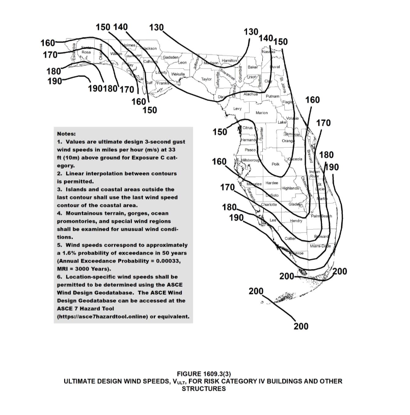
The project consisted of two tasks. Task 1 involved creating updated statewide maps for the 8th Edition of the Florida Building Code. These maps include Figures 1609.3(1), 1609.3(2), 1609.3(3), 1609.3(4), and the Wind-borne Debris Region Map.
Task 2, focused on developing local wind speed line maps for specific jurisdictions. This task had three parts. In Part 1, preliminary maps were created using GIS data and relevant information. Major roads, canals, rivers, and lakes were used to determine the exact locations of the wind speed lines. In Part 2, the GeoPlan Center worked with jurisdictions to make any necessary changes or updates to their maps. Finally, in Part 3, digital copies of the maps were provided to the Department of Business and Professional Regulation in three formats: JPEG, ArcGIS, and Adobe PDF files.
The GeoPlan Center also developed a map including wind zones and links to the maps for each jurisdiction. A view of this map is seen in the bottom right.
The wind speed GIS data is available for download from FGDL:
- ASCE/SEI 7-22 Risk Category I Basic Wind Speed Map (300yr) for Florida – 2021
- ASCE/SEI 7-22 Risk Category II Basic Wind Speed Map (700yr) for Florida – 2021
- ASCE/SEI 7-22 Risk Category III Basic Wind Speed Map (1700yr) for Florida – 2021
- ASCE/SEI 7-22 Risk Category IV Basic Wind Speed Map (3000yr) for Florida – 2021
Information on historic wind speed GIS data available for download from FGDL available here.