Update as of October 2025: All parcel layers (including historic versions) have been removed from FGDL per a request from the State Geographic Information Office (GIO). You can learn more on our Parcel layers removed from FGDL per state request blog post.
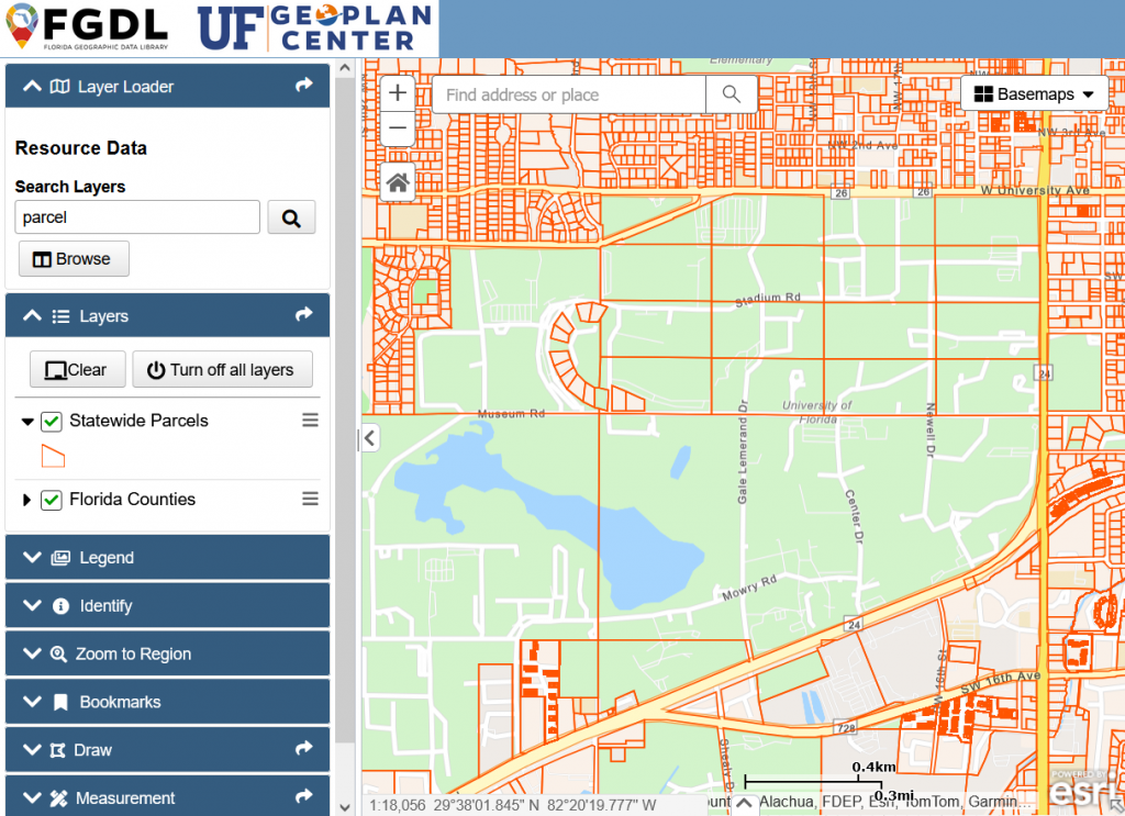
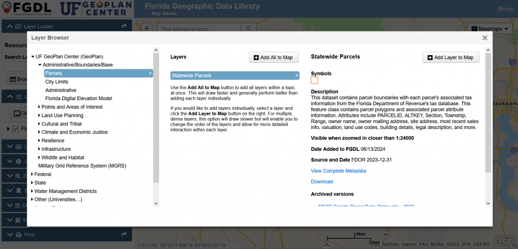
The GeoPlan Center annually compiles a standardized and cleaned statewide parcel dataset to support parcel-based analysis. The dataset includes parcel boundaries and associated tax assessment information from the Florida Department of Revenue (FDOR) tax rolls. The most current version is available for viewing and download in the FGDL Map Viewer.
The Importance of Parcel Data
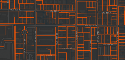
Property parcel databases can provide valuable insights for analyzing land use changes, growth trends, property valuation, and more. In Florida, GIS-based parcel data and tax rolls are maintained by each of the 67 County Property Appraisers, who are required to submit their data to FDOR annually.
Standardization for Accuracy and Consistency
While the statewide database is useful for multi-county and statewide analysis, additional cleaning and standardization are necessary for accuracy across counties and time periods. For example, GeoPlan adds new fields containing standardized city names and zip codes for the physical addresses, which enable seamless calculations, such as summarizing tax information for a specific zip code of group of zip codes. Additionally, land use descriptions are added to FDOR land use codes to facilitate easier interpretation.
The GeoPlan Center also conducts spatial data reviews to improve dataset reliability. This primarily involves repairing geometry where needed and resolving duplicate parcel IDs. Some parcel data are stored as multi-part parcels, with multiple spatial features for one parcel ID. The GeoPlan Center joins these to a single record to ensure proper summary calculations.
Addressing Inconsistencies in Condominium Data
Condominium property records are not stored uniformly across counties. Some counties represent individual condo units as stacked polygons, while others store the entire condo building as a single polygon with a separate file for unit information.
For a few counties with large numbers of condo units stored in separate files, GeoPlan creates stacked polygons to establish a one-to-one spatial-to-attribute relationship, ensuring consistency in cross-county analyses. In the GeoPlan Center’s parcel dataset, this process adds approximately 370,000 condo owners to the statewide dataset.
Key Attributes in the Parcels Dataset
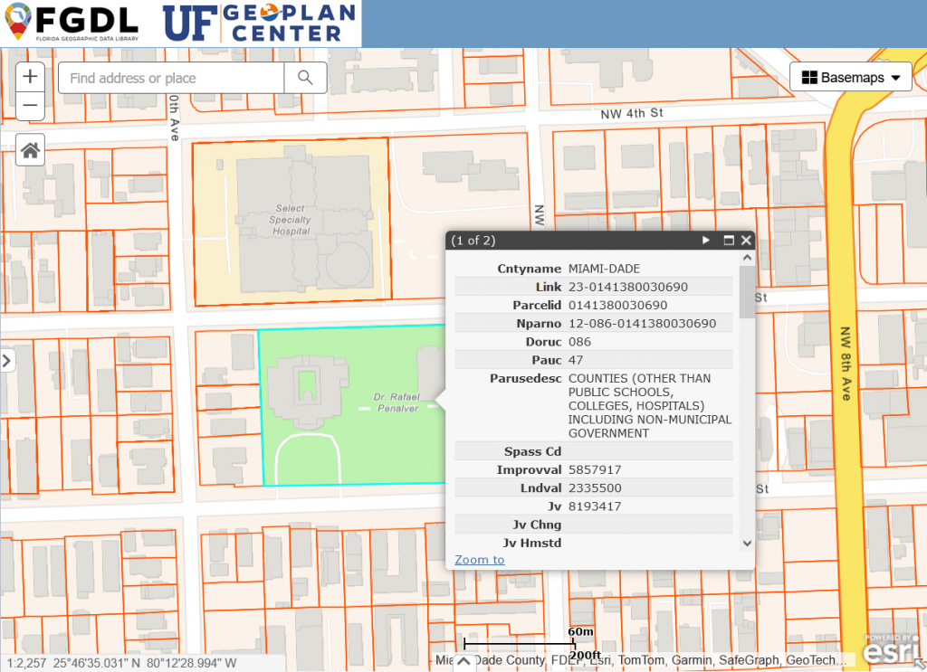
The parcels dataset contains essential property and tax roll information, including but not limited to:
- Physical address
- Owner name
- Land use codes
- Land value and market value (“just” value)
- Tax assessment values
- Building details (e.g., square footage, year built, construction class).
For more information, please see: Florida Parcel Data Statewide – 2023 Metadata – FGDL
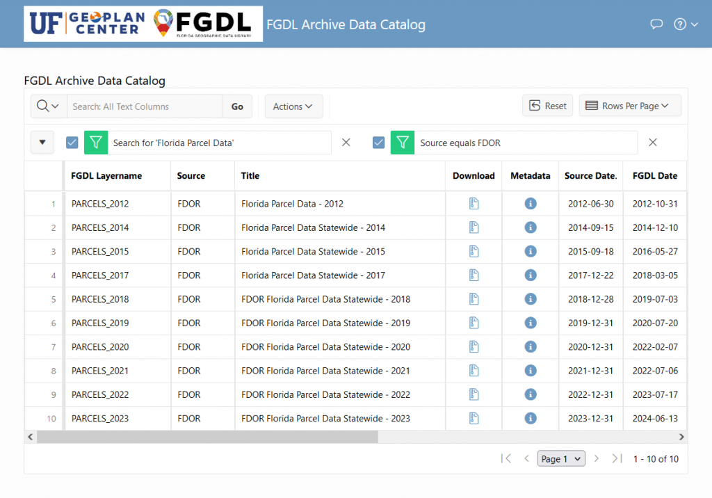
Accessing Historic Parcel Data and Derived Datasets
Historic parcel data, going back to 2007, is also available in the FGDL Archive Data Catalog. Currently, the following years are available: 2007, 2012, 2014, 2015, 2017, 2018, 2019, 2020, 2021, 2022, 2023.
GeoPlan also derives other data layers from the parcel dataset, including a layer of generalized land uses and a layer showing areas by decade of year built.
- GEOPLAN Generalized Land Use Derived from 2023 Florida Parcels
- GEOPLAN Parcels Dissolved by Decade of Actual Year Built in Florida – 2023
Sources / Learn More
- Florida Parcel Data Statewide – 2023 Metadata – FGDL
- What is Parcel Data? – State of Conneticut Data and Policy Analytics
- Parcels in the parcel fabric – Esri
- Introduction to the parcel fabric – Esri