
Happy New Year from the GeoPlan Center! It was another productive year for our center, providing geospatial expertise and support for a variety of projects on and off campus. Here’s a few highlights from 2024:
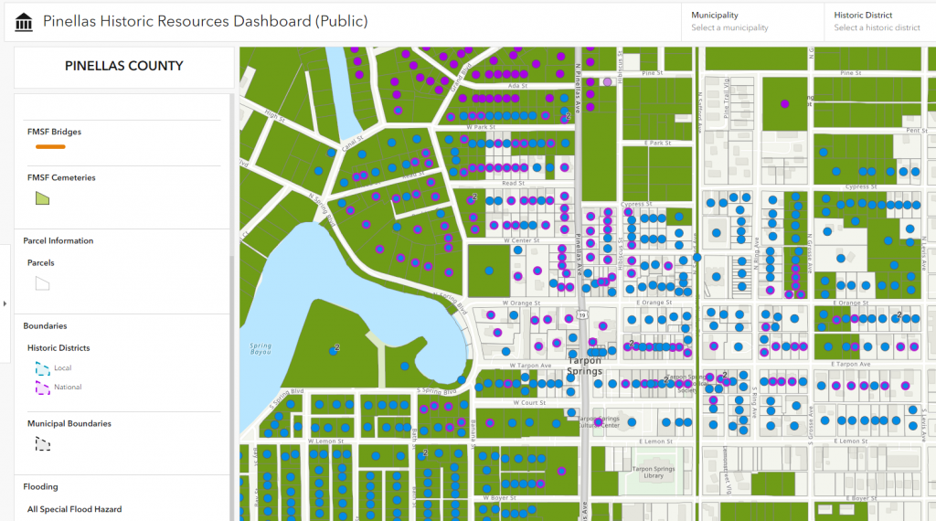
- Collaborated with the UF Historic Preservation Program and Pinellas County to build a database of historic resources
- Collaborated with the UF Health Jacksonville Office of Research Affairs to enhance the Active Clinical Trials Dashboard with improved functionality. The dashboard now enables researchers and administrators to better explore and analyze the spatial distribution of participants in UF Health Jacksonville’s active research studies.
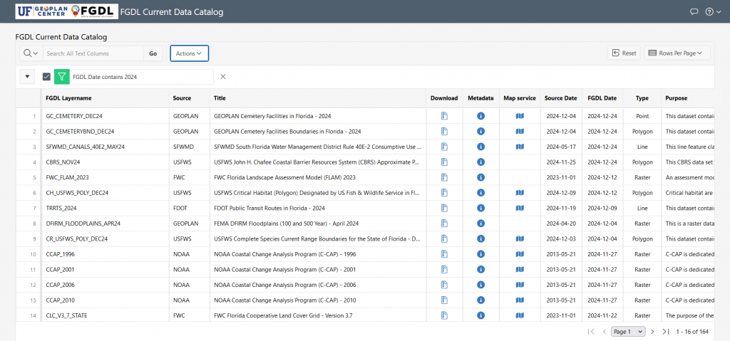
- Added over 300 geospatial data layers to FGDL
- GeoPlan Students assistants traveled to Seoul, South Korea; Boulder, Colorado; and Boca Raton, FL for summer internships.
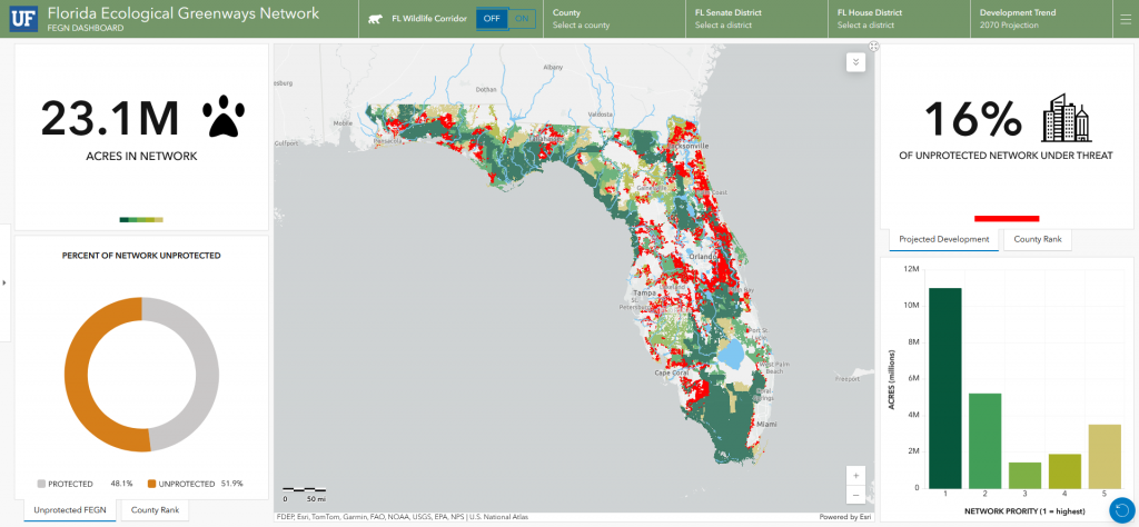
- Continued our partnership with the UF Center for Landscape Conservation Planning, helping them to develop online tools to support protection of the Florida Ecological Greenways Network and the Florida Wildlife Corridor. More tools to come in 2025!
- Continued improvements and technical training for the Resilience Report, a tool to systematically and rapidly conduct flood vulnerability assessments for transportation projects.
- Supported the Florida Digital Twin project with our geospatial and software development expertise. We contributed to building 3D models of Jacksonville for flood impact visualization and developing a custom online mapping platform.
- Successfully navigated the campus Esri site license’s sunset of ArcMap on November 22, 2024.
- Welcomed 13 new students and said goodbye to 10 graduating students in the Online GIS Certificate.
As we reflect on 2024, we are grateful for our faculty, staff, students, project partners and collaborators. Cheers to a successful year and continued geospatial solutions in 2025!